Founding launch · America's 250th

Be a founding member

Personal or department-wide access
$2.50 first month
Be one of the first.
Get Started →
Then standard monthly pricing · cancel anytime
Now in Beta

Drop Pins.
Share Maps.
Coordinate Ops.

FieldOps is a real-time shared mapping app for teams in the field. Drop a pin — everyone sees it instantly. Ground crews on a phone, support teams on a tablet, drone pilots on a controller, command on a desktop — all on the same live map. Pilots fly to pins dropped by ground teams. Ground teams see what the pilot marks from the air. GPS coordinates, What3Words, notes, and photos — shared the moment they're created. No accounts. No setup. Just open and go.

Command
Pin Dropped
FieldOps live map with an incident pin
Team Online
6 Active
Map Layer
Satellite
Pins Dropped
12

One map. Field crews and command in sync.

Drop pins from the field. Watch live operations and drone positions from the office. Enterprise capability without the enterprise price tag.

One tap — on every screen, instantly01 / 10

Hover a feature to preview itTap a feature to preview it

Run your whole operation from one place

Admins control the team, the access, and the setup — so the right people see the right operations, and nobody else does.

Named team roster

Add members by name, set each person's role per project, and give them their own login Password. Edit or remove anyone, anytime.

Three permission levels

Admin (full control), User (add and edit pins), Viewer (read-only) — set per person, per project. The project-level admin shows as "Project Manager" in the app.

Five ways to share a project

Viewer or User links, with or without a project password, or a named-member invite — the only way to grant admin. Share by link or QR code.

Per-project passwords

Lock any project behind its own password. Change it once and every shared link for that project is revoked at once.

Run multiple operations

Keep separate projects going at once, each with its own pins, team, and access.

Drone roster

Register your drones and set each one's map icon and color.

Custom SOG hosting

Upload your Standard Operating Guidelines PDF, or link a hosted doc — it appears in the app for the whole team.

Quick setup

Set your app name, pin types, and default workflow — the Setup Wizard configures pin types for your use case in seconds.

Be one of the first.

FieldOps is live. Get started — personal or department-wide — for $2.50 your first month, and take your place as a founding member. Be one of the first.

Brand-new, and improving daily. FieldOps just launched — not a beta, but new. Founding members get in first and help shape it; expect the occasional rough edge as we polish fast.

$2.50 first month
Scout
Core
$9.99/ mo standard
For small teams and individual operators.
  • 2 admins, 10 users, unlimited viewers
  • Up to 5 active operations
Core — included on every tier

Real-time shared mapping, unlimited pin drops with GPS + What3Words + notes + photos, all base-map styles (Satellite · Topo · Street · Hybrid), Locate Me + Follow Me, every share method with per-project passwords and access control, and the Offline Companion.

$2.50 first month
Command
+ Drone Package
$29.99/ mo standard
For departments and multi-team operations.
  • Unlimited admins, users, viewers, and active operations
Everything in Ranger, plus the Drone Package

Live drone tracking on the shared map, drone telemetry + camera target, custom drone markers, and a live drone-video stream via MapNova. (Native in-app streaming is in development.)

Enterprise
Coming soon
Let's talk
For large agencies and multi-department deployments.
  • Custom seats, onboarding, and support
On the roadmap

Everything in Command, plus enterprise controls. Talk to us →

$2.50 for your first month. After your first month, your plan auto-renews at standard monthly pricing for the tier you selected (Scout $9.99 · Ranger $19.99 · Command $29.99). Cancel anytime. Founding pricing available through July 31 2026.

Runs on your controller

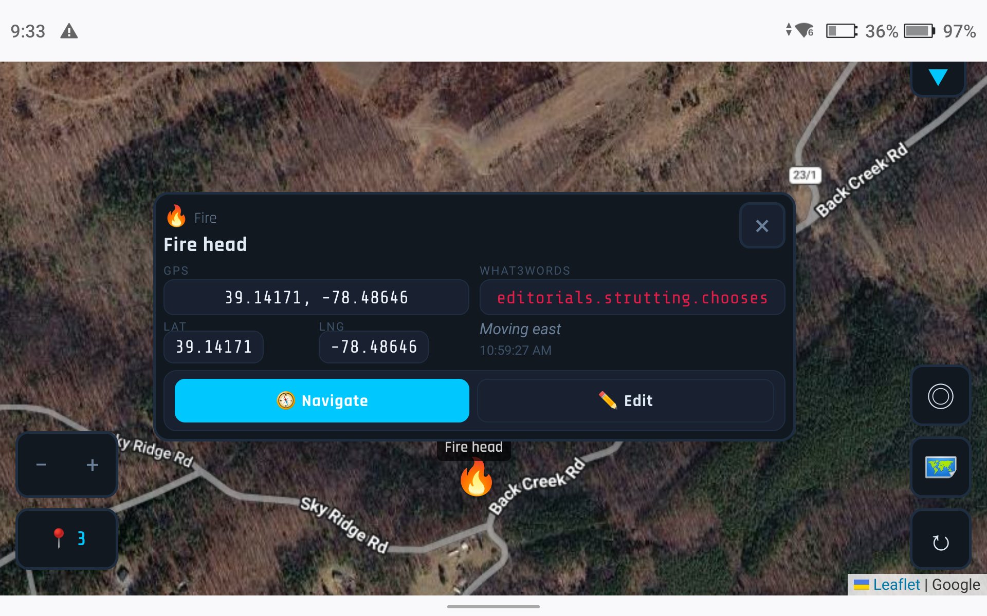
FieldOps works on DJI Enterprise controllers right out of the box. No sideloading, no companion app — just open the browser.

FieldOps running on DJI Enterprise controller

DJI Enterprise Controllers

Open FieldOps in the controller's built-in browser. Drop pins, view the shared map, and coordinate with your team — all from the same screen you're flying on.

The two-column layout adapts automatically for landscape mode, putting GPS data and What3Words side by side for quick reading at a glance.

DJI RC PlusDJI RC ProAny Android Controller

Your drone, on the team's map

See your drone's live position, laser aim-point, and health data — right alongside ground team pins. Every responder sees what the pilot sees. Works with DJI Enterprise drones through Pilot 2.

Learn More →

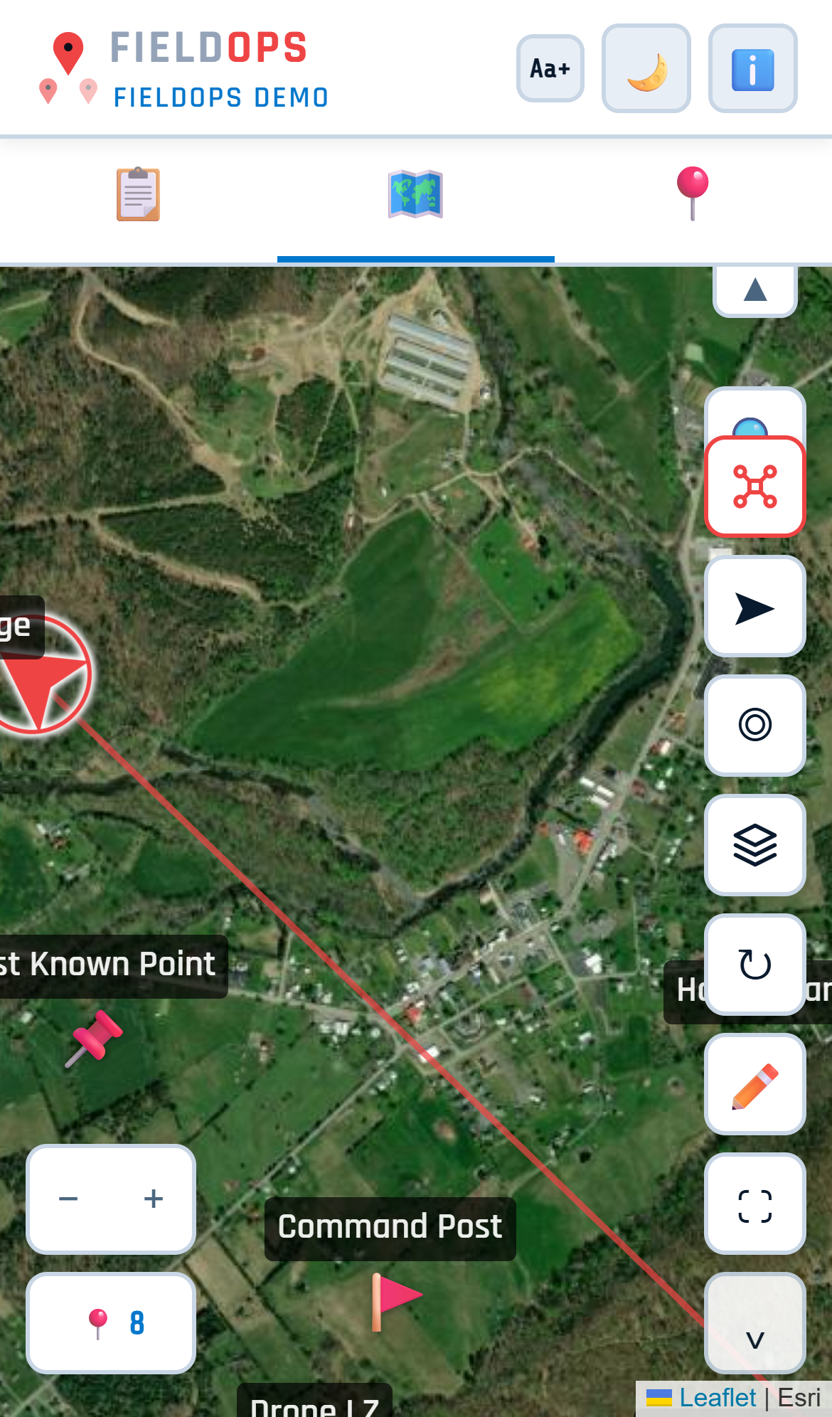
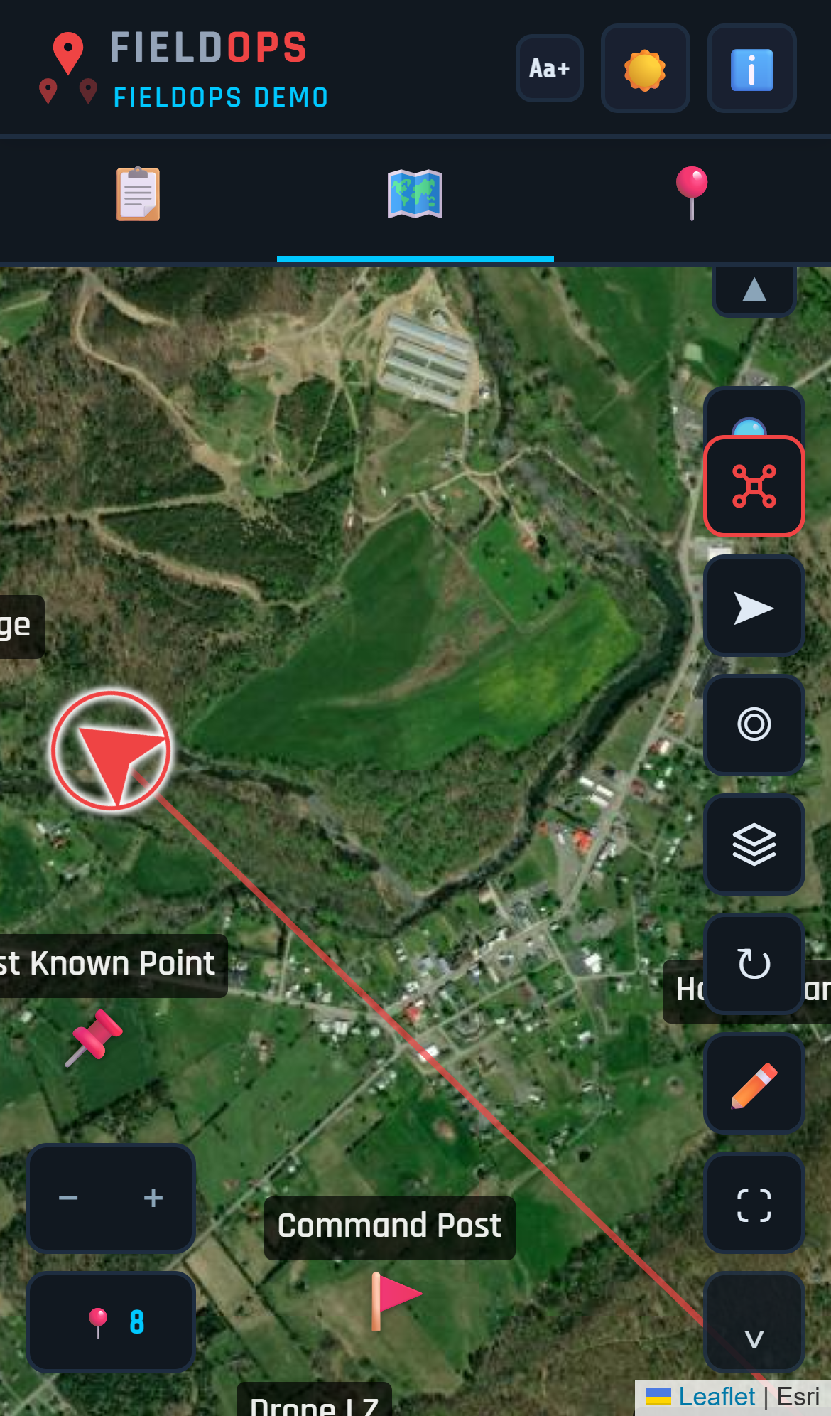
Dark mode. Light mode. Your call.

Toggle between dark and light themes with one tap. Dark mode for night ops and bright sunlight glare. Light mode for indoor briefings and print-friendly views.

FieldOps light mode
FieldOps dark mode
LightDark

Built for teams in the field

From emergency response to outdoor recreation, FieldOps works wherever you do.

Fire Rescue

Fire Departments

Wildfire mapping, structure assessment, scene documentation. Pin hotspots, track crews, share aerial feeds with command.

Search and Rescue

Search & Rescue

Grid search coordination, POI marking, area clearance tracking. Every searcher sees every find in real time.

Law Enforcement

Law Enforcement

Scene documentation, traffic reconstruction, tactical overwatch. Secure team-only maps with PIN access.

Emergency Management

Emergency Management

Damage assessment, resource deployment, incident mapping. Multi-agency coordination on a shared operational picture.

Drone Deer Recovery

Drone Deer & Livestock Recovery

Spot a thermal hit, drop a pin, and guide the hunter straight to it. GPS coordinates, property boundaries, and a clean recovery report — all from the air.

Outdoor Recreation

Outdoor Recreation & Field Teams

Any group that needs to share locations and coordinate in the field — from trail hikes to ranch work to construction sites.

Location-Based Games

Coordinate raids, share rare spawns, and plan routes with your group in games like Pokémon GO, Ingress, and more. One shared map, no app download needed.

Plus hundreds of other uses

Hiking & Trail Groups
Group leader drops pins for waypoints, rest stops, and points of interest. Everyone sees the route on their phone in real time. Use Follow Me to track each other's progress on the trail. Share the map with a QR code at the trailhead — no app download needed.
Hunting Parties
Mark tree stands, ground blinds, drives, and property boundaries on a shared map. Everyone sees where each hunter is positioned — critical for safety. Use parcel overlays (WV counties today) to confirm property lines and permission status before the hunt.
ATV & Off-Road Groups
Share trail pins and mark obstacles, washouts, gates, and rally points. Download offline maps before heading into areas with no cell signal. The whole group stays on the same map even when spread across miles of trail.
Event Coordination
Pin stations, checkpoints, parking areas, first aid, and volunteer positions for festivals, races, and community events. Share the map via QR code on flyers or at registration. Update positions in real time as the event unfolds.
Farm & Ranch
Mark fence breaks, downed trees, livestock sightings, water sources, and equipment locations. Use parcel overlays (WV counties today) to see property boundaries. Share the map with ranch hands or neighbors. Offline maps work in areas with no signal.
Construction & Survey
Mark corners, utilities, access points, and hazards. Share the live map with field crews, inspectors, or subcontractors via QR code. GPS coordinates and What3Words on every pin make it easy to communicate exact locations.
Real Estate & Land
Walk a property and pin features — well, septic, corners, views, access roads, streams. Share the pinned map with a buyer or agent. Parcel overlays (WV counties today) show boundaries, owner info, and acreage. GPS data makes every pin verifiable.
Location-Based Games
Coordinate with your group in games like Pokémon GO, Ingress, Monster Hunter Now, and more. Share raid locations, mark rare spawns, and plan Community Day routes together. Drop a pin when you spot something — everyone sees it instantly. Share the map via QR code so anyone can join in seconds.
Personal & Casual Use
Plot anything on a map — project locations, travel plans, favorite spots, bucket list destinations, property comparisons. Drop pins, add notes, and share the map with a link. No setup, no account, just open and start pinning.
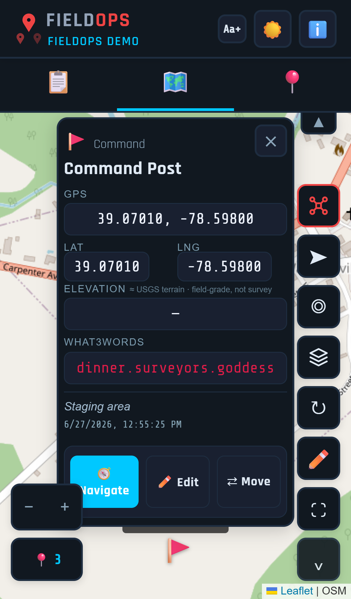
Four steps. Zero friction.

Your team is operational in under a minute. No app store. No accounts. No training day.

1

Open your link

You get a dedicated address. Open it on any phone, tablet, or controller — it's a PWA, installs like an app.

2

Enter your PIN

No email, no password, no account. You — and any team members — enter a PIN and you're in. Field-ready in seconds.

3

Drop pins

Tap the map to mark points of interest. Add notes, photos, categories. Every pin syncs to the shared map instantly.

4

Coordinate

The whole team sees every pin in real time. Command has the same picture as the pilot. Everyone's on the same map.

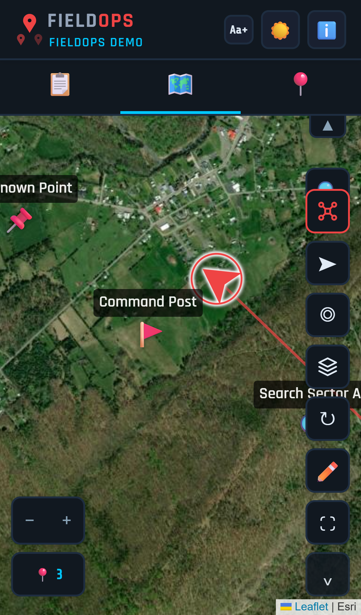
Position your team from the map

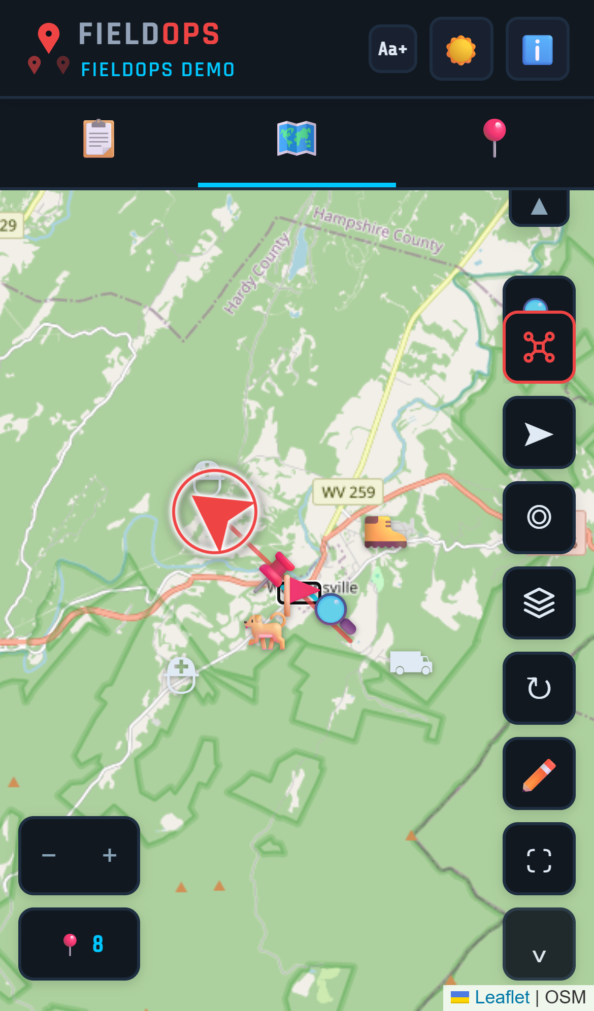
Drop pins for each unit or team member, label them, and drag them into position. Everyone on the team sees the deployment plan update in real time.

FieldOps team deployment on satellite map

The road ahead

Recently shipped, and where FieldOps is headed next. A roadmap is direction, not a delivery date — every item ships when it's ready, no countdowns.

Beta

Advanced on-map tools

Draw and measure right on the map — sketch search areas, mark distances, and annotate the operational picture for the whole team.

Released

Drop pins when you lose signal

Pins drop locally during signal outages and sync back automatically when signal returns. Critical for field reliability.

In development

Live drone safety alerts feed

DJI safety alerts (Health Management System) surface in the app as they happen — not just on the controller.

Released

Import pins from a spreadsheet

Round-trip: export pins to CSV, import them back into a project. Continue sessions across devices, restore previous operations, or load pins from another source.

Released

Offline Companion upgrades

Labels, notes, pin types, edit and delete points, manual coordinate entry, breadcrumb tracking, date-range export, "download this area" affordance, and more.

Released

Property overlays for Offline Companion

Parcel boundaries (select WV counties today) available in the Offline Companion — property lines without cell signal, for SAR and recovery teams.

Coming

Leave Project button

One-tap exit from a shared project, back to the login screen — for guests and members.

Expanding

More supported drone models

As we verify additional DJI hardware end-to-end, the supported-model list grows.

Get started today

FieldOps is live. Set up in minutes — solo or department-wide. Your own space, your team (or just you), your drones, all on the same live map. Be a founding member for $2.50 your first month. Be one of the first.

Get Started

Questions? Talk to us.

Questions before you get started — or want on the waitlist if founding spots are gone? Tell us a bit and we'll get back to you fast.

What you get

Your own FieldOps on your own subdomain — your team (or just you), your drones, your map. Set it up yourself in minutes, or reach out and we'll help.

Jacob Kirk

Owner, Sky Scout

Volunteer Firefighter and EMT with Capon Springs Volunteer Fire & Rescue. Part 107 licensed remote pilot. Built FieldOps to solve the coordination problems he saw firsthand in the field.

© 2026 Agentic Apples · v48

Compare plans

$2.50 your first month on any tier, then standard monthly pricing. Cancel anytime.

FeatureScoutRangerCommandEnterprise
Core$9.99/mo+ Operations$19.99/mo+ Drone$29.99/moComing soonLet's talk
Core — every tier
Real-time shared mapping & pin drops
GPS · What3Words · notes · photos
All base maps · Locate & Follow Me
Sharing, passwords & access control
Offline Companion
Operations Package — Ranger and up
Parcel / property overlays
On-map drawing & measurement (Beta)
Operations & Recovery Reports
CSV import & export
AI assistant
Custom SOG hosting
Drone Package — Command and up
Live drone tracking on the map
Drone telemetry + camera target
Custom drone markers
Drone-video livestream (via MapNova)
Team & scale
Admins24UnlimitedCustom
Users1020UnlimitedCustom
Active operations510UnlimitedCustom
ViewersUnlimitedUnlimitedUnlimitedUnlimited

Enterprise is coming soon — talk to us. $2.50 first month, then standard pricing for the tier you choose. Parcel / property overlays currently cover select West Virginia counties — more areas coming, additional parcel data by request where available.

All Features

Mapping & Navigation
  • Real-time shared map with GPS pin drops
  • What3Words address on every pin
  • Street, Satellite, Topo, and Hybrid map layers
  • Search by address, GPS coordinates, or What3Words
  • Offline maps — download tiles for areas without cell signal
  • Follow Me breadcrumb trail
  • Navigate to any pin
  • Drag-to-deploy — move pins to assign team positions
  • Pin labels visible at zoom
  • Dark and light mode
Pin Types & Categories
  • Pin type library with suggested labels
  • Search & Rescue pin category
  • Recovery & Thermal pin category
  • Incident Command pin category
  • Mass Casualty pin category
  • Setup Wizard auto-configures pin types for your use case
Property & Parcels
  • Parcel boundary overlays with offline storage
  • Tap any parcel for owner name, address, acreage, GPS
  • Property permissions — Granted, Denied, N/A with color-coded borders
  • Copy parcel info to clipboard
  • Available in select WV counties today — more areas coming; additional parcel data by request
Team & Access
  • Team and drone roster management
  • Named member accounts with roles and PINs
  • PIN access control — Admin, User, Viewer
  • Temporary PINs with auto-expiration
  • Request Access flow for visitors
  • Role-based project visibility
  • QR code sharing
  • Multiple projects and operations
  • Copy Project
Reports & Documents
  • Auto-generate mission report PDFs
  • Deer or livestock recovery reports
  • FAA SGI waiver auto-fill
  • Custom SOG hosting (PDF or URL)
  • Workflow Guides for Wildland Fire, SAR, Deer Recovery, Tactical, MCI
Drone Integration (Command tier)
  • Live drone position on shared team map
  • Laser rangefinder aim-point — see where the camera is targeting
  • Health Monitoring System (HMS) alerts for the whole team
  • Battery, altitude, heading, speed, gimbal angle telemetry
  • Drone registration with account-isolated credentials
  • Pre-flight visibility — see who's flying what
  • Verified: DJI Matrice 4E / 4T with Pilot 2 + RC Plus
  • Expected support: Matrice 30/30T, M300 RTK, M350 RTK, Mavic 3E/3T
Integrations & Platform
  • DJI Enterprise controller support
  • Livestream integration (MapNova)
  • AI assistant
  • Subscription tiers — Scout, Ranger, Command
  • PWA — installs like a native app
Ask about FieldOps
Hi! I can answer questions about FieldOps — features, use cases, setup, pricing, whatever you want to know. Ask away.