Drone Integration — shared awareness, drone-augmented
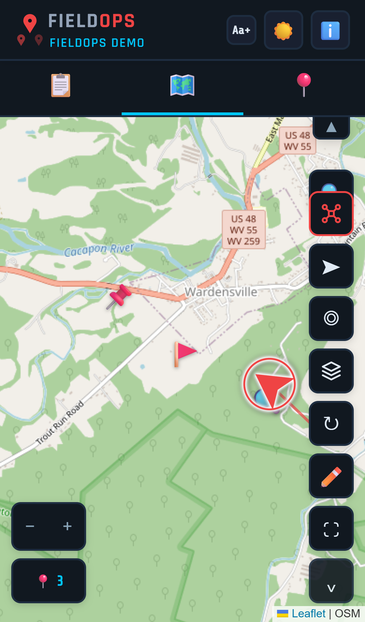
Your team sees where the drone is, where it's looking, and what it's measuring — inside the same map everyone's already using. Just the drone, on the map, with the rest of the team.
DJI Enterprise → FieldOps, live
Register your drone in FieldOps, connect through DJI Pilot 2, and the bridge handles the rest. Your drone's position, camera aim-point, and battery flow to the shared map in real time. Every responder on the team sees it — not just the pilot.
What's working now
Drone Position on Map
Live aircraft location visible to every team member on the shared map. See where the drone is, in real time, alongside ground team pins.
Laser Rangefinder Aim-Point
Continuous stream of the ground point the LRF is targeting, rendered as a distinct marker. The whole team sees where the camera is pointing.
Drone Registration
Three-tier model picker in-app. MQTT credentials provisioned server-side.
Telemetry Data
Battery, altitude, heading, speed, remaining flight time — all flowing to the team map.
Pre-Flight Visibility
Registered drones visible to your whole team. Incident command sees who's flying what before the drone leaves the ground.
Coming soon
Flight Path Trail
Visual breadcrumb history of where the drone has been, with trailing fade. See coverage at a glance.
Native Drone Video Stream
Drone camera feed built directly into FieldOps — no third-party service required. Watch the drone's live video inside the app alongside the shared map.
AirSense Alerts
DJI's manned-aircraft proximity warning surfaced to the whole team, not just the pilot's controller.
Works with DJI Enterprise drones through Pilot 2
FieldOps connects to DJI Enterprise drones via the DJI Cloud API and DJI Pilot 2. Consumer drones (Mavic, Mini, Air, Avata) use DJI Fly and are not supported.
| Aircraft | Controller | Status |
|---|---|---|
| Matrice 4E / 4T | RC Plus + Pilot 2 | ✓ Verified |
| Matrice 30 / 30T | RC Plus + Pilot 2 | ✓ Verified |
| Matrice 300 RTK | RC Plus + Pilot 2 | Expected |
| Matrice 350 RTK | RC Plus + Pilot 2 | Expected |
| Mavic 3 Enterprise (M3E / M3T) | RC Pro + Pilot 2 | Expected |
| Consumer drones (Mavic, Mini, Air, Avata) | DJI Fly | Not Supported |
FieldOps is not a drone fleet management platform
Tools like DroneSense, FlightHub, and AirHub are built for drone program management — fleet logging, certification tracking, DFR workflows. FieldOps is different. It's an incident operations platform that integrates drone telemetry into the shared map your whole team is already using. The drone is one feed contributing to shared situational awareness — not the product itself.
Ready to put your drone on the map?
Drone tracking is the Drone Package, and it comes with Command and Pathfinder. Get set up and connect your first drone in minutes.
Get Started